
As already stated elsewhere, I’m very lucky to live in a part of the Europe where the rest of Europe goes on holiday. As such, I recommend you come and see it for yourself, so I will not spoil your future experience of it with photos of stunning landscapes that do not do them justice. Okay, just one.
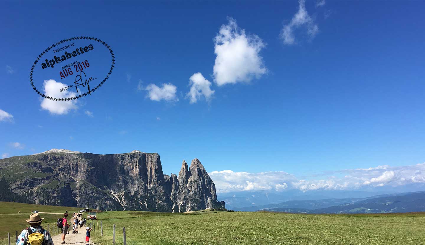
Schlern, a beautiful rock in the Dolomites.
What I really want to talk about is the wayfinding system of the hiking trails, because it’s pretty special. As a bonus, I’ll try to convince you that a signpost is a map.
The Seiser Alm (where the Schlern can be seen) is one of my favourite places to go hiking (read: walking for a few hours in order to reach a Hütte that serves delicious food and walk back and erase any butter-guilt [butter-guilt: that feeling you get when you realise there was half a pound of butter in your food]). It is the largest high altitude Alpine meadow in Europe, right in the centre of the Südtirol region, and is reachable by different cable cars according to where one is coming from. At the top there are hundreds of walking and hiking trails and Hüttes (restaurants).
Upon arrival, one is greeted by this magnificent map:
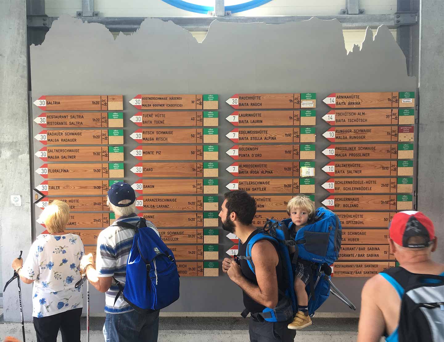
A map? you ask, well yes.
Bear with me. A map is a diagrammatic representation of an area of land showing physical features such as roads.
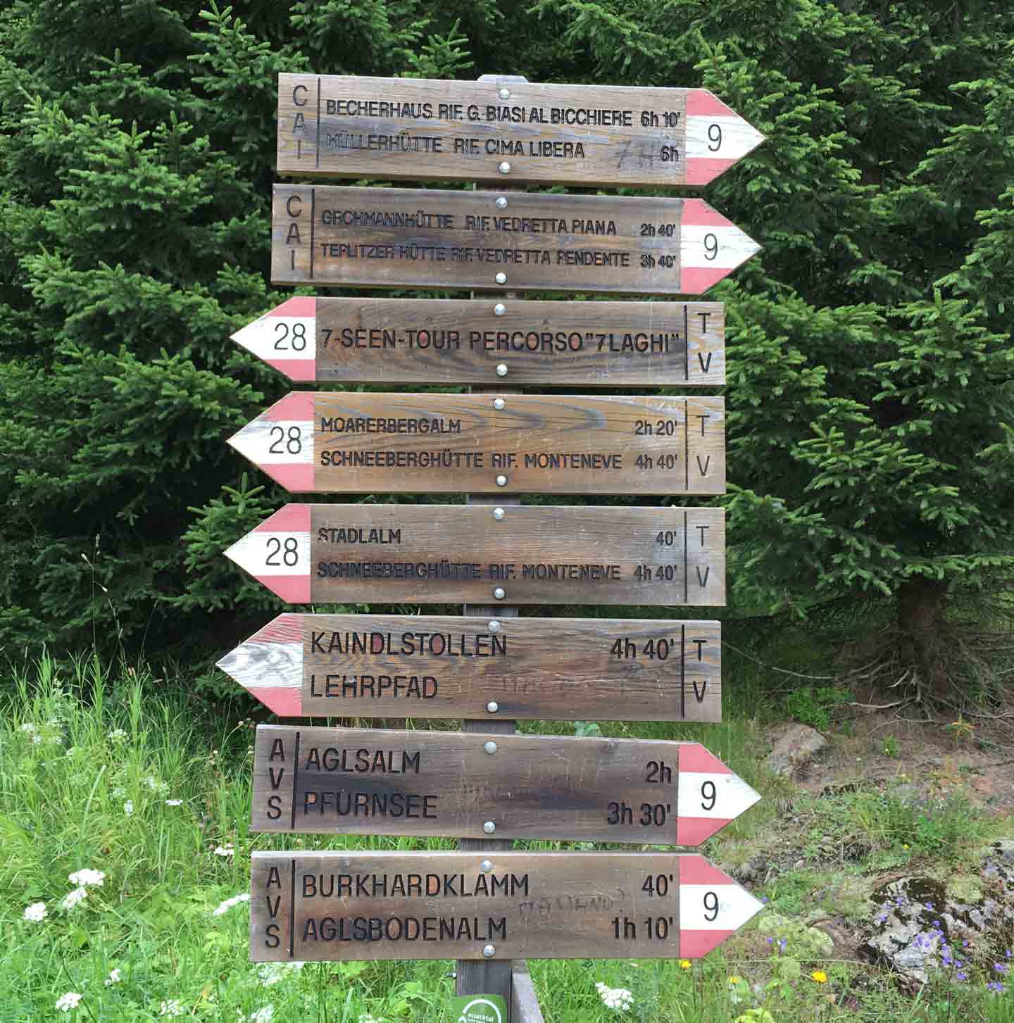
This one here shows: walking paths, distances (expressed in walking times, because distance means nothing if there’s no indication of how steep the path is!), and destinations (these are usually food related, as previously reported).

Speck and cheeses
This map shows destinations and distances, and directions on how to reach them. Bonus: it even tells you whether the place you want to go to is open. What is missing in this map is the representation of the physical area, and this is what makes it the best walking map ever: the only way to get that representation is to actually lace up your boots and walk. It’s a deconstructed map, where the representation of the area is delegated to the area proper. Once you decide where to go, the map comes to life.
If you look closely, you can see that this map has been amended by someone who didn’t agree with the length of one of the trails. Is this crowd-mapping or what?
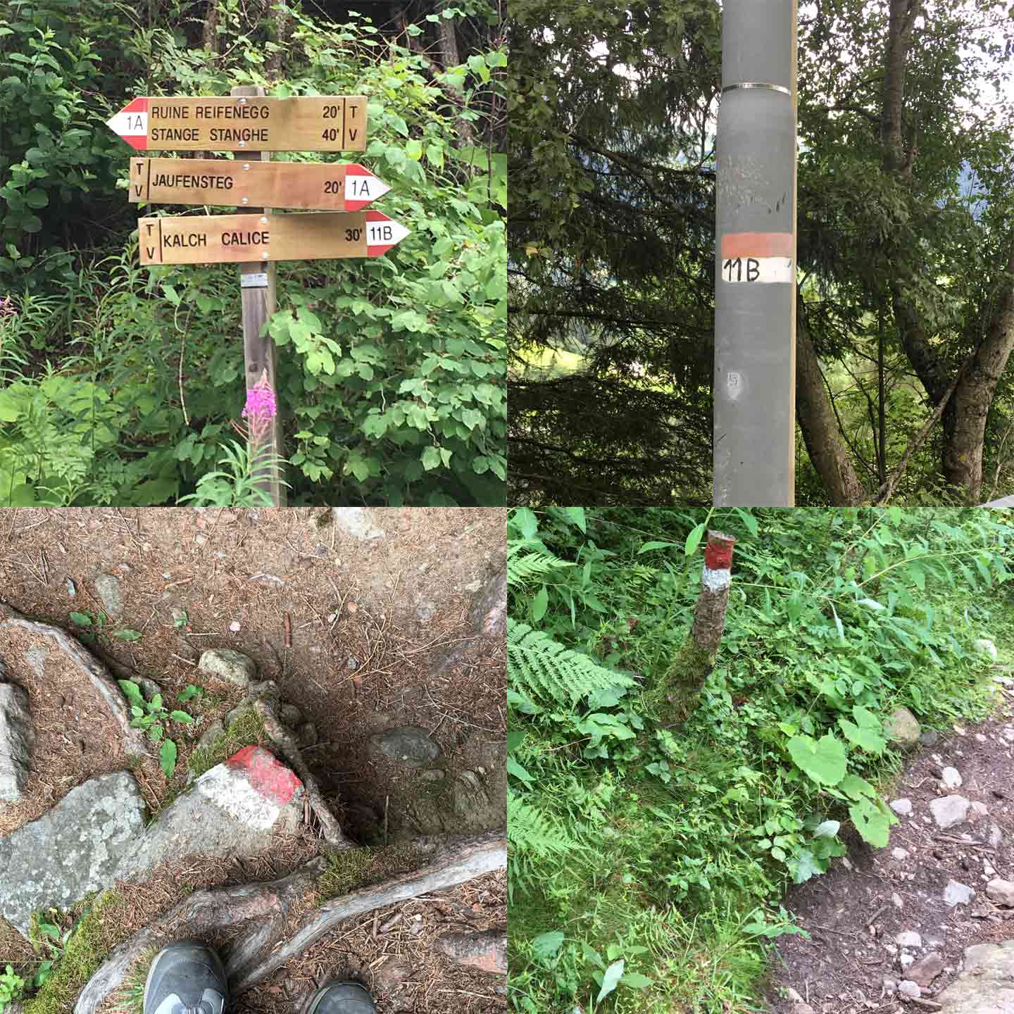
The fascinating quality of this kind of map is that it is not an abstract representation of the space, but it is directly on the space. You choose a destination, and then follow your route not for a certain distance, but for a certain time. At every node, you may find confirmation that you are indeed on the right path (just like you would on a paper map: node, go right or go left or keep going straight), and often, along the way, you will find markings that tell you that you are not lost.
Next time I’ll take you on a virtual tour of interesting, modern or ancient, blackletter signs in the mountain Hüttes. This time, I’d love to hear your thoughts on my signpost-as-maps theory. Comments are open.
This post is part of Greetings from, a series in which Alphabettes share typographic curiosities from around the world. Look out for a passport stamp in the photos to spot posts from the series, or read them all here.
Lehrpfad wins the award for the most unrelated consonants together in a row. Is the hütte worth it after 4 hours and 40 minutes?